Extended School Vacations?

January 2, 2014

What would you do with an extra day or two of vacation? Wind chills ranging from -15 to more than -35 on Monday  in Missouri and Kansas might be enough to cause concern for school officials.

Wind Chill Regional Jan 6 2014

While the Arctic blast is a certainty, students and teachers should hold off making their plans until exact wind chills are known and they hear the official word.


Why will this “Arctic Blast” be Different?

December 2, 2013


Today’s warm-up across the Central Plains is aided by a lack of significant snow cover. Our air is able to modify and warm-up more because of the bare ground in the “Arctic Blast’s Alley”. We’ve already had two major shots of cold air flow through that same “alley”.


Current Snow Depth


As we head through winter, this “alley” will likely become snow covered. Over the next few days, the Northern High Plains will get a good layer of snow. Air travelling over this route will have less bare ground, hence even colder air plunges into the Central Plains. Since the energy of any warm-up near our source of frigid air will be used to melt snow, we’ll stay colder longer.

So wrap up your outdoor activities and get ready for another taste of winter.


Forecast Snow Depth


Effects of Humidity

High Temperatures - May 14, 2013

High Temperatures – May 14, 2013

When temperatures reached the low 90s in Kansas City yesterday, most of us feared we’d be sweltering. After lows in the 30s, we weren’t ready for the 90s!

Yet last evening was downright comfortable: golfer’s smiled, gardeners were ecstatic and few air-conditioners were turned on.

Today it’s nearly 10 degrees cooler but feels less comfortable. What’s up with that? The dew point is what’s up.

Last night’s dew point in the 40’s made us completely forget about our high temperatures in the 90’s. Essentially, yesterday we got a taste of what people in the Southwest call “dry heat”. Since their thermometers read triple digits for months on end, let’s not sign up for that and be glad our “dry heat” day was relatively mild.


One of the Snowiest 7 Days on Record!

OP_SnowKansas City has been walloped by back-to-back storms that brought the city to a standstill. Schools, colleges, businesses and entire shopping malls were closed in both events that occurred less than a week apart from each other.  The 20.3″ between Thursday, February 21 and Wednesday, February 27 were the 2nd snowiest seven days in the Kansas City record books which date back to 1888.

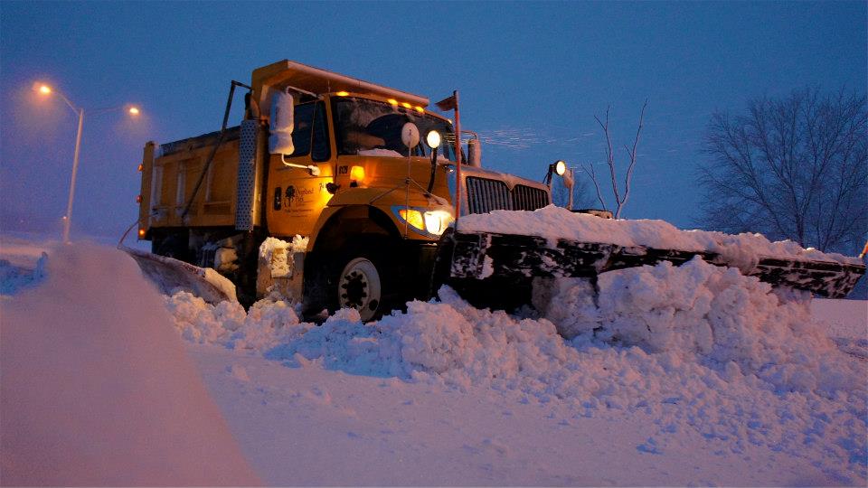
The first event in Kansas City dumped 9.3 inches of snow (9.2 inches on February 21 and 0.1 inches on February 22) much of which came between 8am-12pm when snowfall rates peaked as high as 3 inches per hour and was accompanied by thunder! The 9.2 inches in a single day ranks 5th highest for the month of February. The situation turned dire within an hour of the start of the snow.  Traffic log jams created by stranded motorists were everywhere.  Even causing I-35 and highway 69 to close.  As a result, snow plows were immobilized across the metro and in some instances causing ambulances and other first responders from getting where they needed to go.

Crews worked tirelessly on Friday and through the weekend. Their purpose was the find a new home to the snow piles before the next blizzard-like blast arrived.  The next record breaking snow ramped up Monday night while most folks slept. Heavy wet snow accompanied by thunder continued through the morning hours on Tuesday, February 26th. Snow crews were battling again clearing more than 9 inches of snow that finally ended the following day. The three calendar day total for the event was measured at 11.0″ at the official observation station for Kansas City, the Kansas City International Airport.

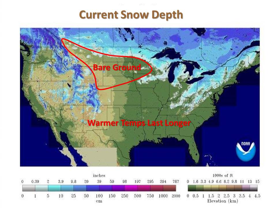
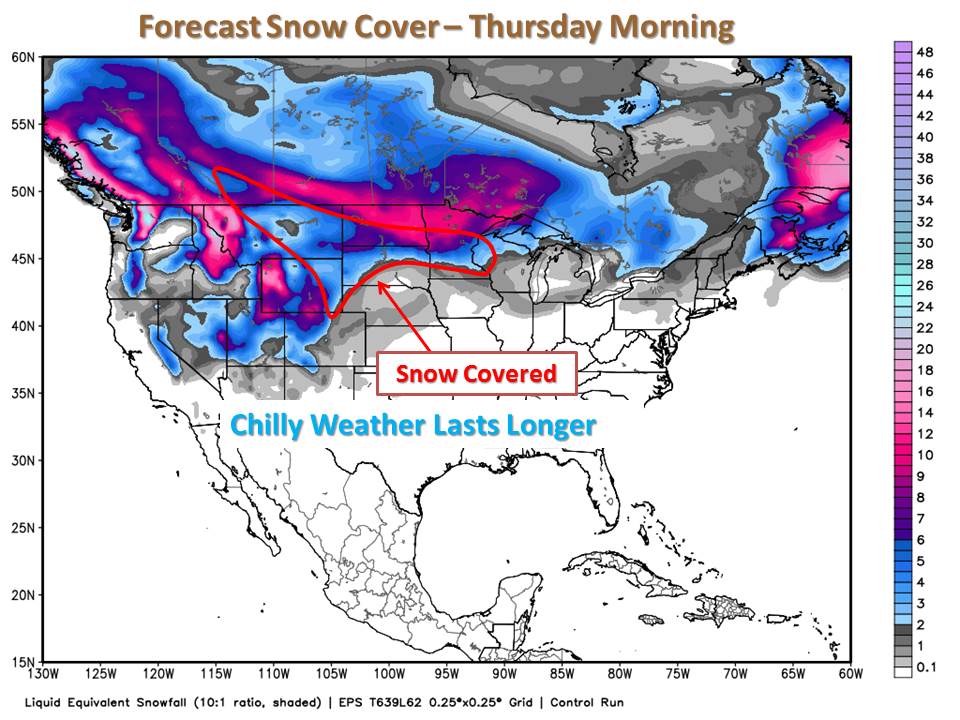
While the chilly blast this weekend could bring spurts of flurries or light snow, no more records are expected to be set this week…

The 7 day period of February 21-27, 2013 resulted in 20.3″ of snow for KC!


The Snowiest 7-Day Periods on Kansas City Record (since 1888)

1) March 18-24, 1912  (25.1″)
2) February 21-27, 2013  (20.3″)
3) January 14-19, 1962  (19.8″)
4) March 27 – April 2, 1926  (18.8″)
5) January 12-18, 1960  (17.3″)


Fall Foliage

October 8, 2012

Fall foliage is already in full swing across the Northeastern United States, while signs of change are beginning to show up in the Midwest. The typical peak for Fall colors occurs in October, however some areas to the west won’t see their peak until early November.

Normal Time for Peak Foliage Color

Normal Time for Peak Foliage Color

Temperature and soil moisture play a large role in the vibrancy of fall colors.  Warm sunny days followed by cool nights bring the most colorful leaves. These conditions allow the leaves to slowly become dormant,  bringing out the most colorful foliage.  The amount of soil moisture also affects the onset and amount of color seen, with adequate soil moisture providing optimum color.

What can we expect for color this year?

Recent warm days and cool nights have allowed some decent colors to appear in northwestern Missouri.  However, with the lack of soil moisture caused by this summer’s drought we can expect “leaf peaking” to be less intense this fall.


Track Fall Foliage in Missouri –  Missouri Department of Conservation

Read about Fall Colors in Nebraska – Nebraska Games & Parks Commission

Weekly Updates on Foliage in Iowa – Iowa Department of Natural Resources


Dramatic Change!

October 5, 2012

Earlier this week the Central Plains were basking in mild temperatures for early October with highs in the upper 70s to lower 90s!  Now, just one or two days later we have areas of snow and temperatures struggling to reach 50 degrees.  This dramatic change was thanks to a strong cold front that moved across the Central Plains and even into the southern United States.  Take a look below to see just how far those temperatures fell with a comparison of highs on Wednesday or Thursday to the afternoon on Friday.

 Temperature Difference (10/3-4 to 10/5)


Roost Rings

The Kansas City National Weather Service Radar picked up an interesting phenomena on radar this morning over northern Missouri, a roost ring!  Check out the animated image below which shows the radar from 6:47am until 7:42am and focus in on the area northeast of Carrollton, Missouri.

The expanding circular object is actually flocks of birds leaving their overnight stay in local conservation areas, including Fountain Grove, Yellow Creek and Pershing State Park.  A cool phenomena that shows radar doesn’t show you just precipitation!


The First Freeze of Fall 2012

September 21, 2012

While it won’t happen tonight, freezing temperature are inevitable. Fall may just be starting, so patchy frost is not far behind, and eventually a widespread freeze to plants will occur.  Temperatures will often cool faster in low-lying areas and river valleys, where the denser cold air can settle into these lower terrains.  You will also see the first frost and freeze come to rural areas or outskirts of urban areas before the densely populated urban areas.  When can you expect that mercury to drop to 32 degrees?

Average Date of First Freeze

Average Date of First Fall Freeze


Follow along when areas see their first freeze with this map courtesy of the Midwestern Regional Climate Center.  The map will update each morning to show the progression of freezing temperatures.

Date of First Fall Freeze of 2012

Date of First Fall Freeze of 2012

Check back to the Weather or Not Blog to see when freezing invades from Canada!