February 2, 2017
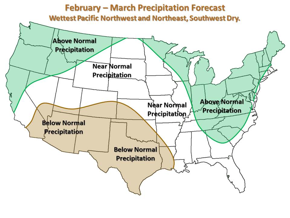
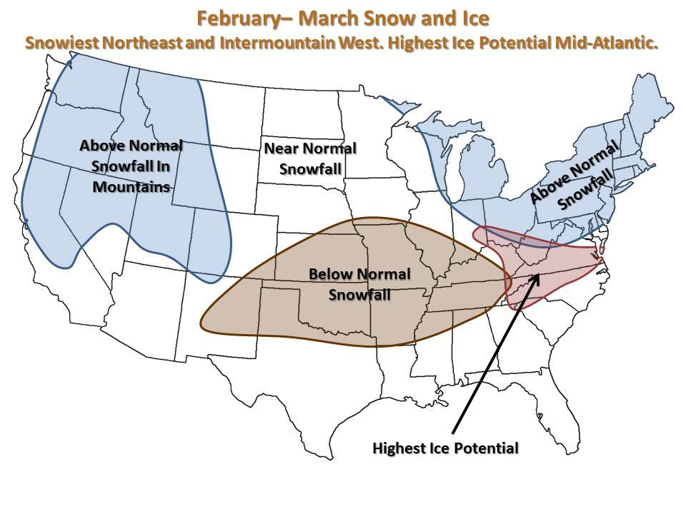
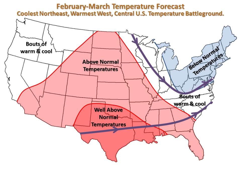
The Northeast, Pacific Northwest, and Intermountain West stand the best chance as wintry conditions through March. With those locations active, the Central U.S. will see limited chances for wintry precipitation, and will also be warmer.
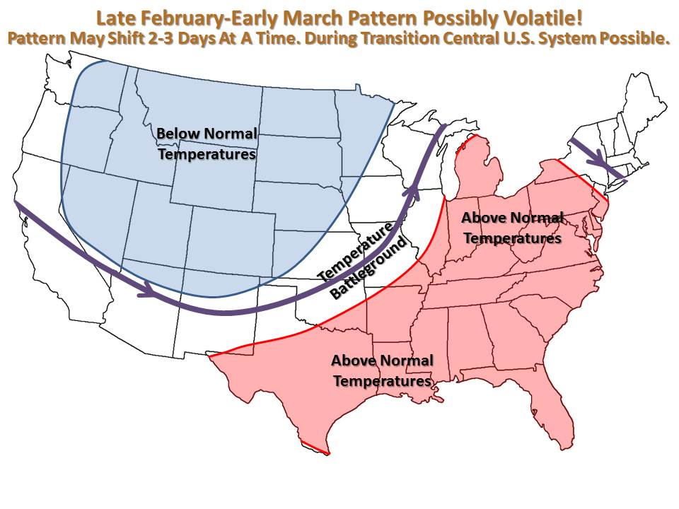
The biggest question mark in the forecast will be February 24th-March 10th, where the pattern could fluctuate every few days, allowing for possibly cool (30s/20s) and wintry systems to traverse the United States. From a Kansas and Missouri Prospective, this will be our best chance as seeing some plowable snow events. As it stands, 1-3 will be possible, with one possibly producing 4”+ of snow.
By mid-March the pattern will calm down, with the West and Northeast seeing winter continue. The Central U.S. will return to mild conditions (60s/40s), and drier more than not.