


August 6, 2013
If you get a break in your water bill this August, you can thank a phenomenon called the low-level jet stream. The low-level jet stream forms during the overnight and early morning hours due to a temperature difference between the Rockies and the Plains. For example, some locations in central Colorado dropped into the mid 40s last night, while mid 70s to low 80s were common across the Plains. This gradient in temperature causes a fast-moving stream of air to develop about 5000 feet above the surface called the low-level jet stream. This stream of air is responsible for much of the overnight and early morning thunderstorms we see during the summer.
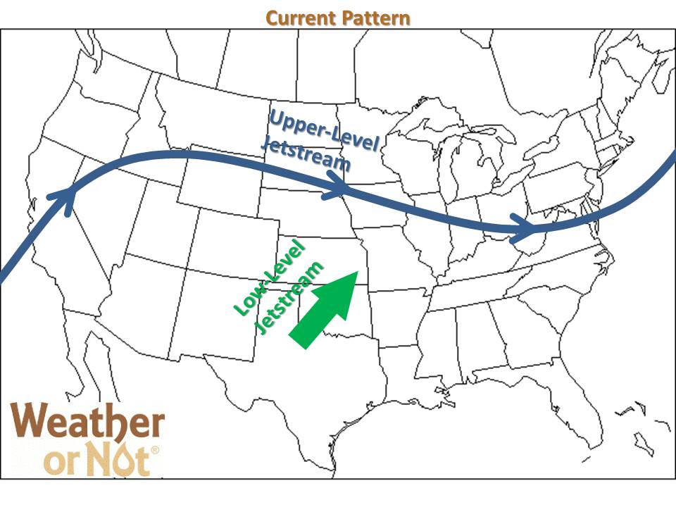
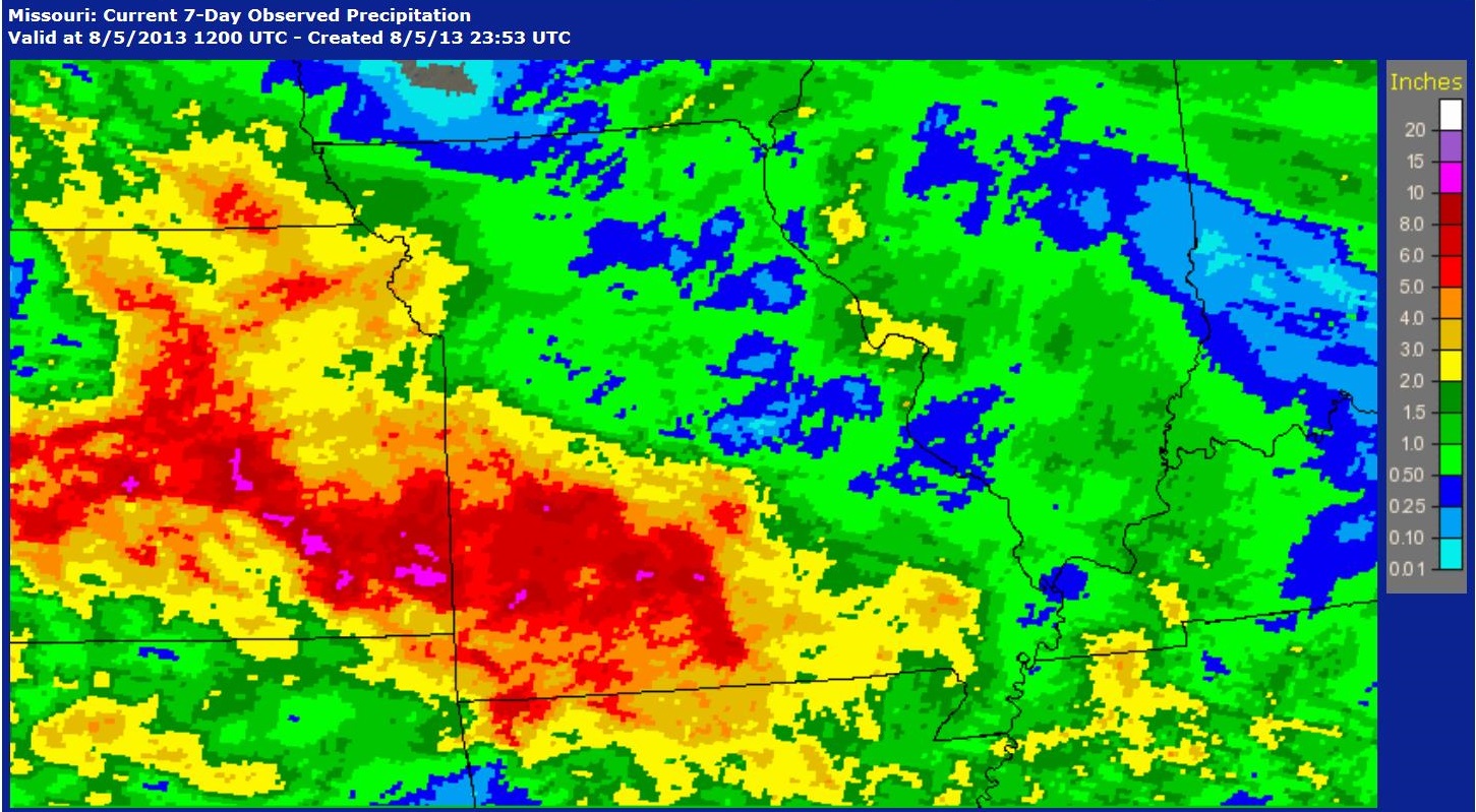
Right now portions of Kansas and western Missouri are stuck in a pattern where the low-level jet stream is nearby just about every night, meaning the rain just keeps on coming. Many locations in southeast Kansas and southern Missouri need the rain to stop, as 5-10 inches of rainfall in the last 7 days continues causing episodes of flash flooding.
Radar estimated rainfall over the past 7 days
Wet August Continues
Unfortunately our current weather pattern is nearly stationary, so wet conditions and areas of flash flooding will most likely continue on and off through at least next week.