November 19, 2012
Break out the shorts for Thanksgiving, winter coats are just around the corner. High temperatures this time of year normally range from the mid-40s in eastern Nebraska to the low 50s from central Kansas to eastern Missouri. Temperatures this week are nowhere near normal with highs soaring into the upper 60s and even 70s in some locations.
If you’ve lived in the Midwest during the winter (last winter doesn’t count), you know the weather scales can tip quickly. Indeed they have already done so this fall (as you can see here). It does look like temperatures will briefly dip after Thanksgiving. However, a much more impressive swing could be in store for the end of the month.

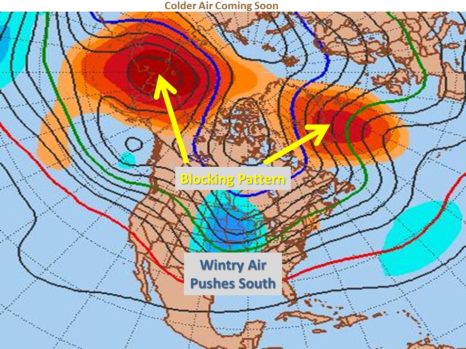
There are many factors meteorologists can look at in determining when the next cold air outbreak may occur in our region. One of these factors is high latitude blocking. When high pressure forms over the high latitudes, cold polar air can be blocked southward into our area. Mid-range forecast models are coming into agreement that a strong blocking pattern will set up over the north Atlantic and north Pacific by the 27th or 28th of November, sending our temperatures plunging by the end of the month.
There are also signs that a storm may try to develop over the western U.S. around that same time. Depending on the track and timing of that potential system, wintry weather could be in store somewhere in our region for the end of the month into early December. No matter when changes come to the Midwest, W.O.N’s meteorologists will be notifying clients well ahead of time.


