Radar Can Be Deceiving


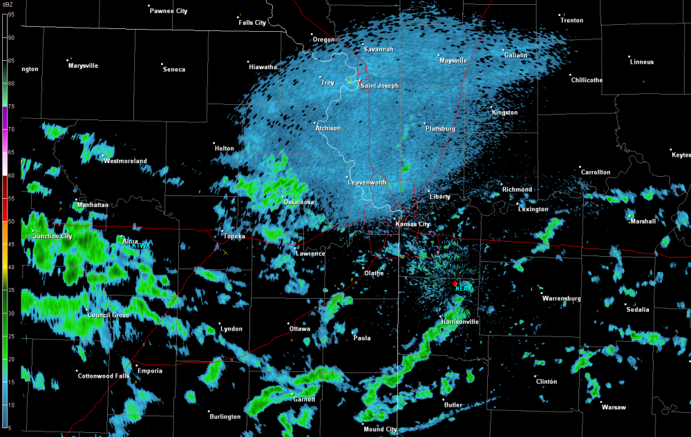
Below is an example of a typical radar image that you will see on your computer, tablet or smart phone.  You can see the characteristic light to dark green values indicating the radar is detecting precipitation, or is it?


Kansas City Base Reflectivity

Kansas City Base Reflectivity


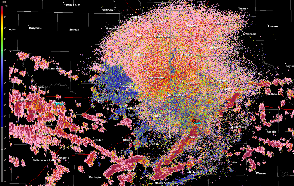
With dual-pol radar products, meteorologists have additional data to differentiate radar echoes that are caused by precipitation versus echoes that can be caused by insects, birds, smoke, etc.


Kansas City Dual-Pol Radar - Correlation Coefficient

Kansas City Dual-Pol Radar – Correlation Coefficient


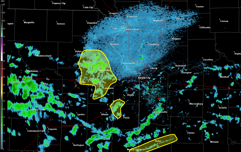
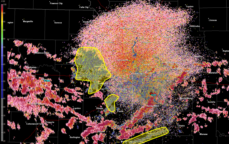
We’ve highlighted the area of interest below which shows light and dark greens that appear to be precipitation at first, however they are actually non-meteorological, meaning it isn’t actually rain!


Kansas City Base Reflectivity - Highlighted

Reflectivity – Highlighted

Kansas City Dual-Pol - Highlighted

Correlation Coefficient – Highlighted


Just another reason why you can’t always trust what the radar is telling you!

Roost Rings

The Kansas City National Weather Service Radar picked up an interesting phenomena on radar this morning over northern Missouri, a roost ring!  Check out the animated image below which shows the radar from 6:47am until 7:42am and focus in on the area northeast of Carrollton, Missouri.

The expanding circular object is actually flocks of birds leaving their overnight stay in local conservation areas, including Fountain Grove, Yellow Creek and Pershing State Park.  A cool phenomena that shows radar doesn’t show you just precipitation!