July 31, 2012

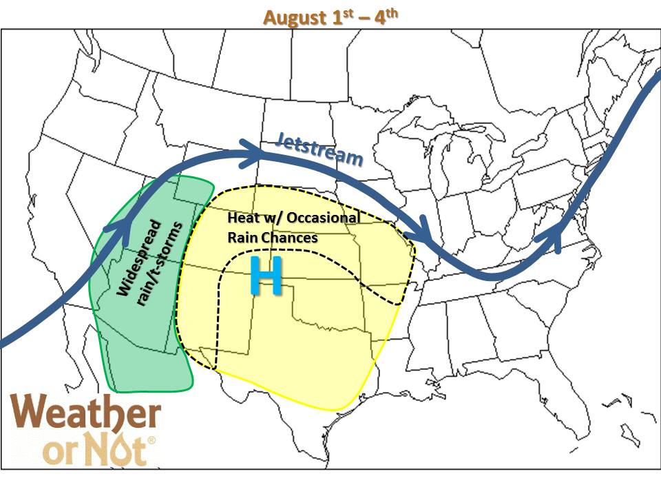
Occasional showers bring cloudy relief to a lucky few this week, but where the sun’s shining, temperatures continue climbing. This pattern is slightly nicer than the pattern we’ve seen so far this summer, with the ridge displaced slightly west. This keeps the hottest and driest weather just west of the Missouri River Valley. As disturbances form over the Desert Southwest, they can climb up and over the ridge, spilling occasional rain chances into our area (ISO 1-1.5). Unfortunately the lack of coverage and intensity of any rainfall continues to disappoint most thirsty lawns.

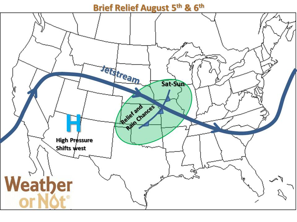
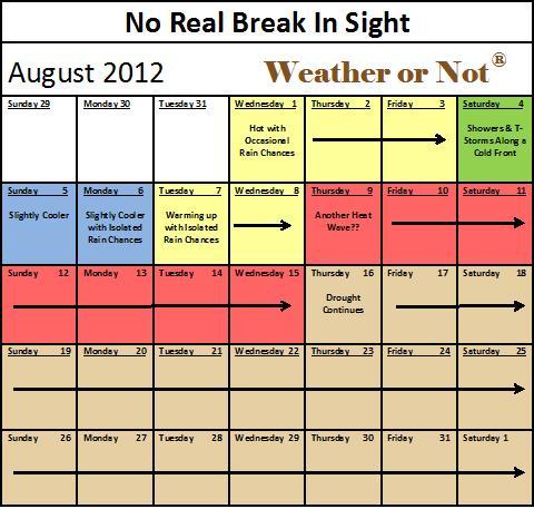
More widespread heat relief and rain chances arrive this weekend as another weak cold front moves through the region. The best potential to be closer to 90 than 100 should be the first day or two after the front passes. Then as the front retreats between the 6th-8th of August, there will likely be a gradual warm-up from west to east, with isolated rain chances continuing. After the 8th, the dome centers over us again causing the rain chances to decrease and heat to increase, with the next potential heat wave looming on the horizon sometime around the 10th-15th of August. So, other than a few lucky locations, there are no signs of significant relief to the ongoing drought or sweltering summer heat.


