In an ongoing saga between the drought and the Mississippi River, the Coast Guard and Army Corp of Engineers have been facing a constant battle in keeping the river open to boat and barge traffic. The U.S. Coast Guard closed an 11-mile stretch of the river on Monday, August 20 after a ship ran aground while traveling near Greenville, Mississippi which has been closed intermittently since July. Other portions of the river are staying open thanks to constant dredging.
A recent New York Times article spotlighted an individual dredge that is working just south of St. Louis. The dredge Potter is said to be sucking up about 60,000 cubic yards of sediment from the bottom of the river and depositing it to the side. The Potter is one of more than a dozen dredges out working on the river to keep traffic moving which is vital to the economy, with barges hauling grain, petroleum and coal among other products daily. Inland waterways carry 60% of the nation’s grain exports, 22% of domestic petroleum and 20% of the coal used to generate electricity with a majority moving over the Mississippi and Ohio rivers.
How low is the Mississippi?
The river gauge at St. Louis has an observed value of -0.74 feet, 17th lowest on record (-6.10 feet on 01/16/1940 is record low).
Memphis, Tennessee’s river gauge has an observed value of -8.73 feet, 4th lowest on record (-10.70 feet on 02/10/1937 is record low).
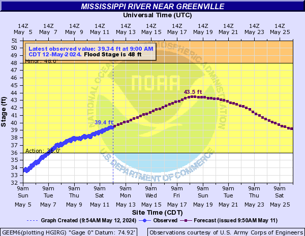
Greenville, Mississippi (near where the river has been closed) has a river level of 7.75 feet, 6th lowest on record (6.70 feet is record low on 01/04/1964).
Check out the hydrograph of each of those river gauges with the images below (will update automatically to the latest river levels).


