Sunday, August 26, 2012
A slow-moving storm brought soaking rainfall to the Central Plains over the last few days. Topeka recorded a daily record of 2.55” of rain for August 25th. Milford Kansas, just west of Manhattan, recorded a whopping 6.01” of rain from this storm!
1-2 inches of rainfall looked like a good bet for Kansas City Saturday night. Many lawns were eagerly awaiting a good drink of H20, but it didn’t happen for Kansas City.
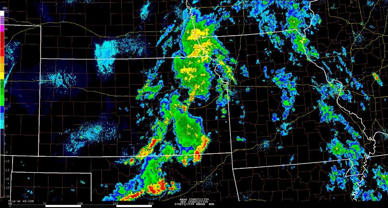
The radar screenshot from ~7pm Saturday evening (left-below) shows widespread thunderstorms developing west and southwest of Kansas City. An increase in winds just above the surface along with a warm, moist fetch of air from the Gulf of Mexico was expected to sustain the storms as they moved into the area. Taking a closer look, you can see a cluster of thunderstorms ahead of the main rain band straddling the Kansas/Oklahoma border. Thunderstorms had been moving northeast throughout the day, which is why Kansas City had good reason to be hopeful.
 Regional Radar 6:59pm |
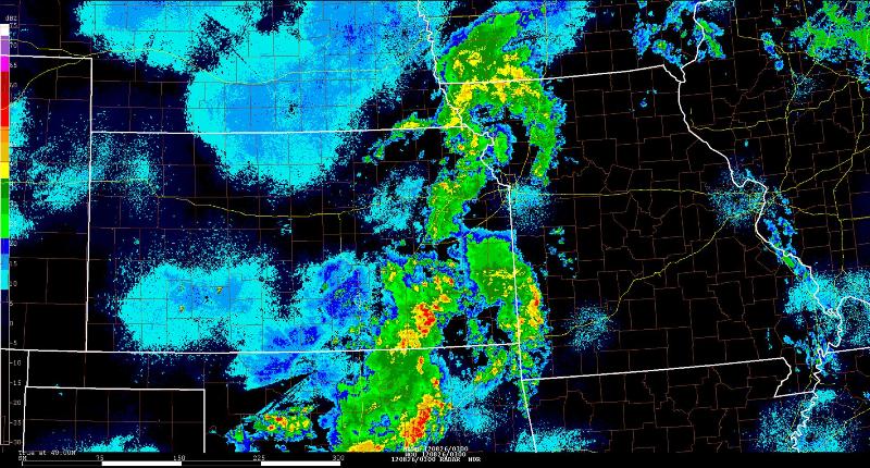
 Regional Radar 10:00pm |
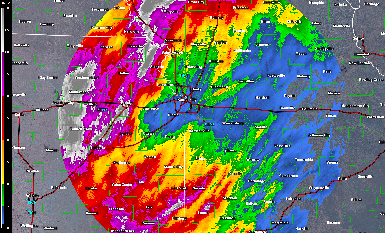
The next radar screenshot (right-above) is just three hours later at 10pm. The cluster of thunderstorms that was along the border raced eastward into Missouri. This cut off our supply of moisture and dashed any hope of significant rainfall. Unfortunately, this created a void over Kansas City as shown below.

Storm Total Precipitation


