Show Us What You’ve Got

w-logo paintingInternships are a great opportunity to discover ways in which you might fit into your chosen field.  Many careers have gotten off to a faster start because students put themselves in a professional situation that showed off their skills and talents to a potential employer while that company introduced them to various segments of their industry.

Weather or Not is searching for our next group of interns.  We currently have opportunities for bright, energetic students in many areas of meteorology, IT, software development and marketing. Our 30 year history includes consulting to the Kansas City Royals, Sporting KC, airports, utilities, facility managers, public works and snow businesses to name a few.  Some of our past interns have even gone on to full-time employment with us!

If you think you’ve got what it takes to intern at Weather or Not, contact us today at hr@weatherornot.com.  We’d love to hear what you’ve got to contribute to our company as we create an exciting start to your professional future.


2016 Summer Outlook

  • High confidence temperatures warm-up late May, but more frequently trend above normal July-September.
  • A few brief heatwaves expected July-August.
  • Typically active rain pattern will be most active May-June; drier July-September.
  • Wet begets wet and dry begets dry, while drought conditions are still possible in late summer,
  • Recent rains have delayed onset of drought.

Probably Warmest Summer Since 2012

http://weatherornot.net/userfiles/image/Seasonal_Outlooks/Spring_Summer_2016/Summer_Temp.jpg

Main Pattern Drivers

  • Strong El Niño
  • Warm Pacific Decadal Oscillation (PDO)
  • A combination of 1 and 2 creates warmer temperatures over Pacific Northwest/Rockies and
  • Great Lakes, which supports a dome of high pressure building over the Midwest.
  • Recent rains

Analog* Year Graphs

http://weatherornot.net/userfiles/image/Seasonal_Outlooks/Spring_Summer_2016/Daysabove_90_100_KMKC.jpg

http://weatherornot.net/userfiles/image/Seasonal_Outlooks/Spring_Summer_2016/Precip_Departure_KMKC.jpg

Expert Analysis

     The ongoing El Niño will weaken considerably over the next several months. This trend will likely be the strongest long-term forecast signal of the 2016 summer.  Abnormally warm water still exists in the eastern Pacific Ocean and along the West Coast. This combination creates the heat in the Central  Plains.
     There is high confidence this summer will be warmer than normal and probably the warmest since 2012.  The sea surface temperature setup favors a persistent upper level ridge centered over the upper Midwest and Great Lakes region. This setup will block Canadian cold air from making its way into the United States. 90s and 100s should be much more common this summer than the past two summers! Near to below normal temperatures should be limited to areas from the Southwest U.S. to Texas.
     The greatest uncertainty comes with the precipitation forecast. Systems during the warm season like to travel along the edge of the high pressure ridge, not through it. So where the ridge lives most of the summer is key. If the ridge centers more often over Illinois, then we will be drier as systems are forced to stay west of the area. If the ridge is centered near Lower Michigan, systems will have a better chance to make it into our area. There are signs this ridge may begin the summer further east/northeast, then retrograde westward into Iowa for the end of the summer. This means May-June should be wetter than July-August.
     Drought conditions and soil moisture are also key for summer precipitation patterns. Those that start dry tend to stay dry through summer while those that start wet tend to stay wet (comparatively) and cool. While drought conditions were beginning to develop across portions of the Plains in March and early April, recent rains have reversed that trend. The forecast pattern over the next 2-3 week is supportive of additional rains, but likely not excessive on a widespread basis.  The potential for an excessively dry summer (like 2012 and 1988) appears to be decreasing because of  the recent rain. The relatively saturated soils should aid in keeping drought conditions at bay through at least June. Thereafter, the high pressure ridge should gradually become more dominant during July, causing rains to become less frequent and possibly a return to drought conditions by August or September.
     The primary factors we looked at when searching for similar years (analogs), were those that featured a strong El Niño during the winter weakening to a La Niña by fall. This search yielded the following analogs correlating respectively: 1998, 1988, 1983, 2007, 2010.


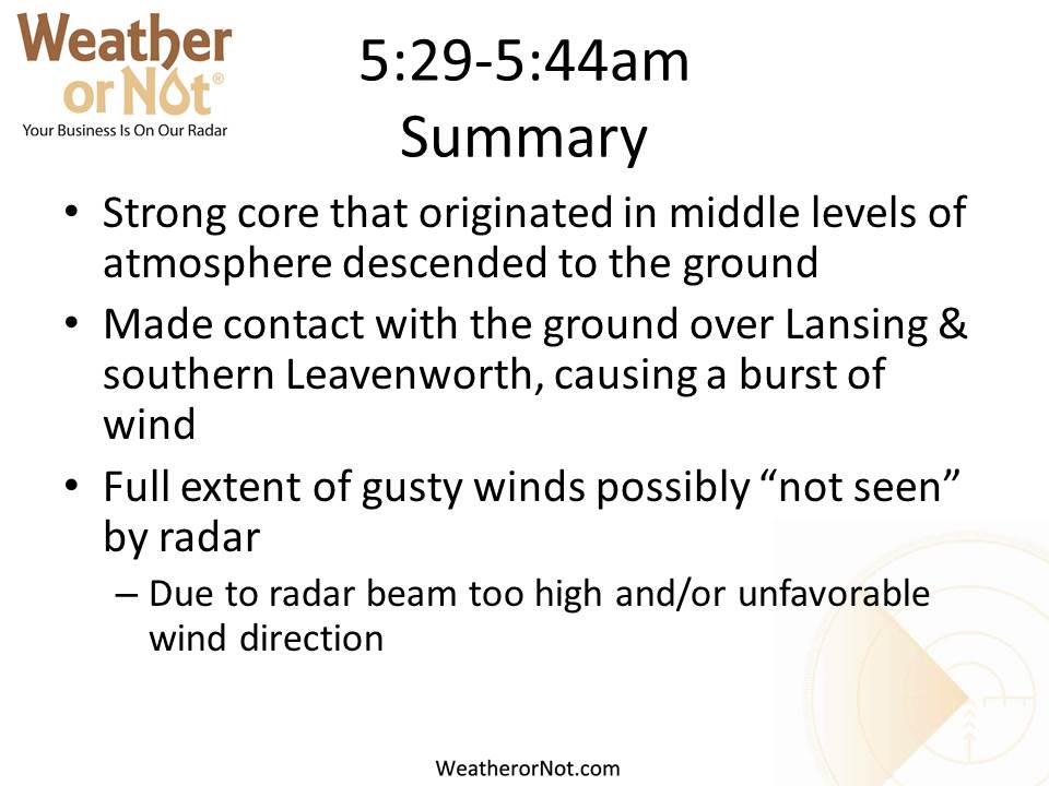
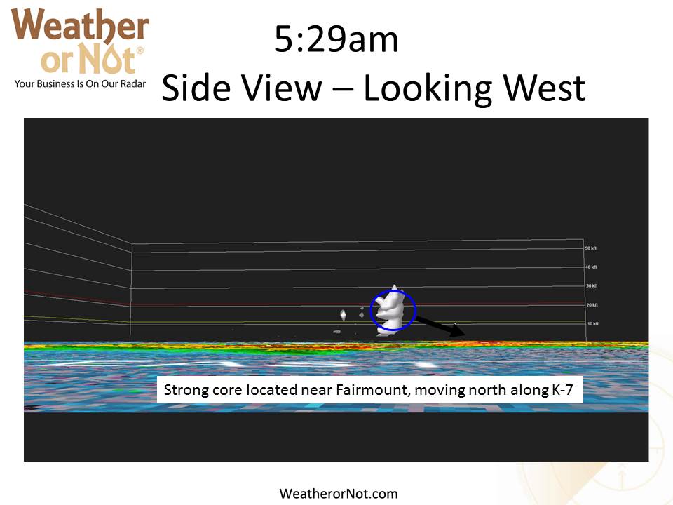
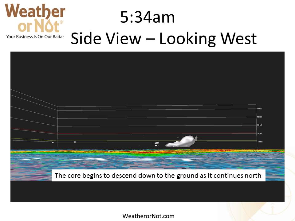
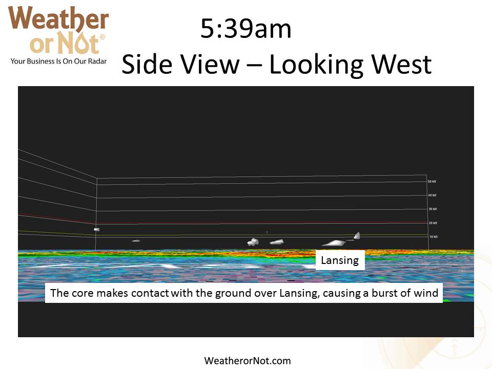
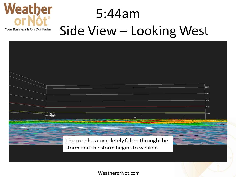
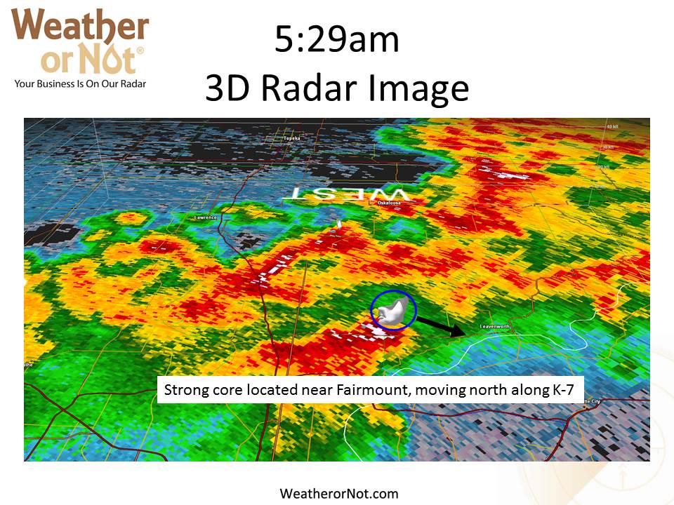
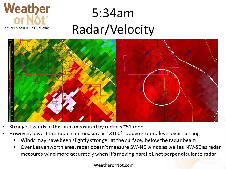
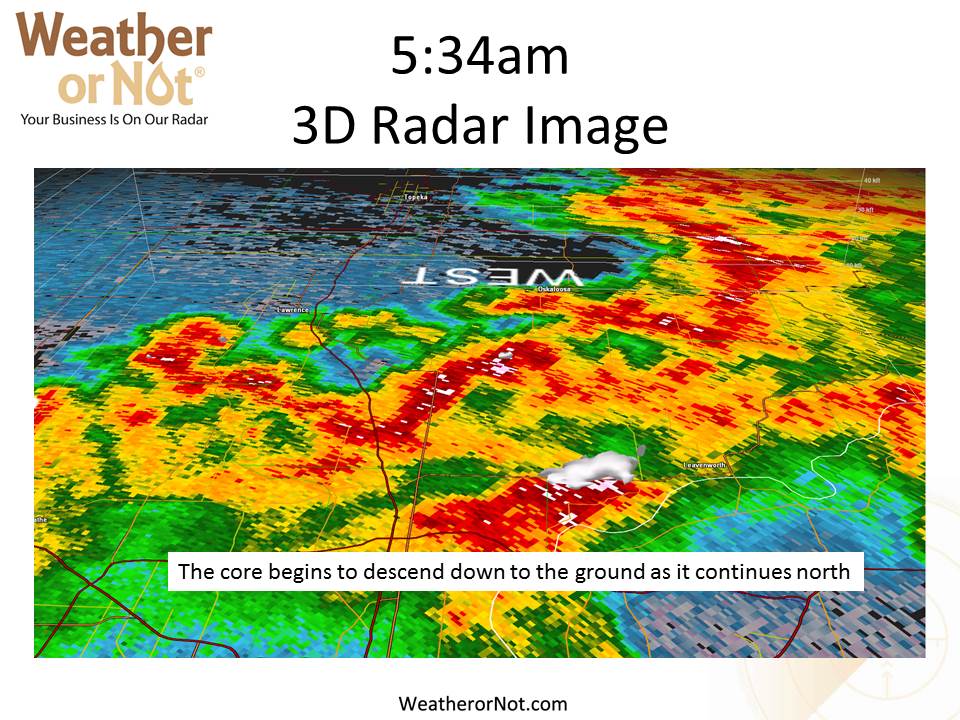
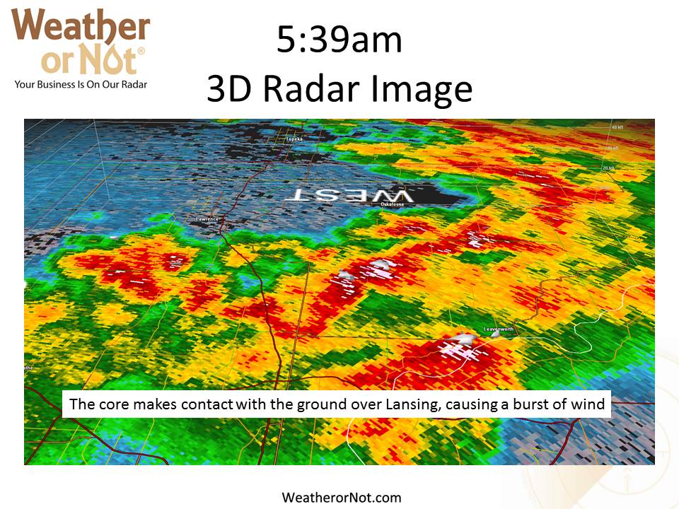
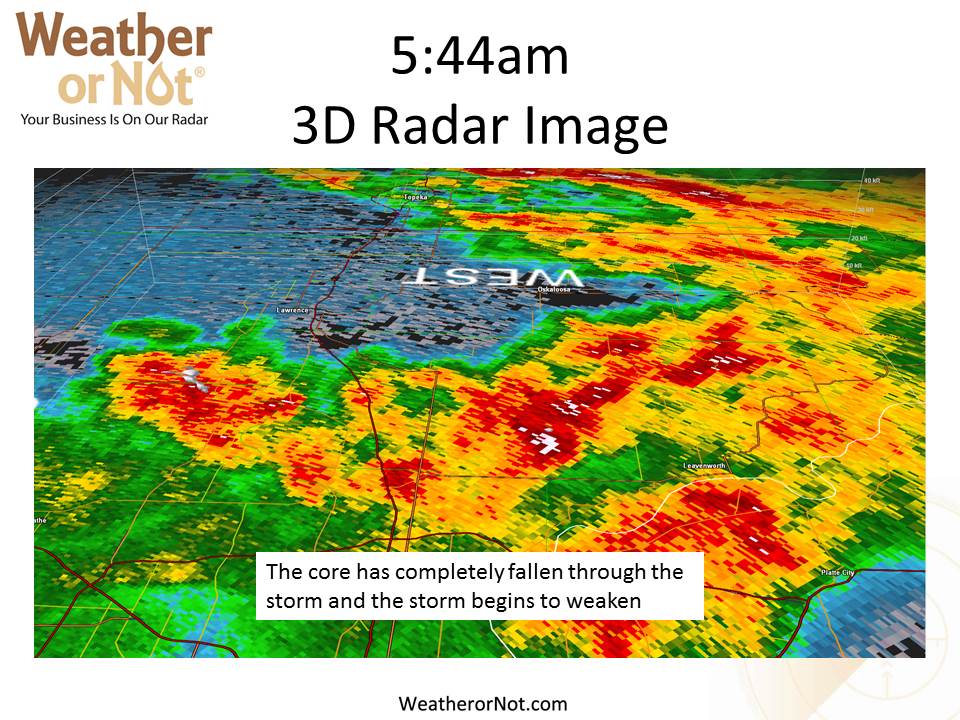
Leavenworth County Wind Storm May 11, 2016

Weather or Not meteorologists review of the Leavenworth County wind storm on May 11, 2016.


Operational Meteorologist, Programming Background Preferred

Are you an energetic, intuitive, detail-oriented meteorologist who wants to turn your forecasting and programming skills into business solutions?  You could become the newest addition to our team.  At Weather or Not, a leader in Midwest commercial weather consulting services, you’ll work directly with construction projects, snow crews, schools, recreation, International Airports, MLB and MLS teams.

Qualifications

  • B.S. in Meteorology or military equivalent experience is required
  • Sharp analytical skills with a strong understanding of Midwest weather patterns and forecasting
  • Superb written and verbal communication skills: must be able to simply explain the impact of complex weather systems on client’s projects while meeting strict deadlines
  • Ability to multi-task under pressure while maintaining a calm demeanor
  • Strong computer skills using GEMPAK, GRAnalyst, GREarth, Bufkit, MS Office, Linux required. Experience with ArcGIS is preferred
  • Experience with programming and database management is preferred (i.e. C++, C#, Java, PEARL, PHP, Python, MATLAB, SQL, R, etc.)
  • Knowledge of Air Quality Forecasting, such as ground level ozone is a plus
  • Expertise in developing a WRF model, weather apps, and/or web-based weather solutions is a plus
  • Innovative thinking with developing digital solutions to weather impacts is preferred
  • Keen eye for customer service
  • Demonstrated work ethic and professionalism

To apply, please send cover letter, resume (including references) and salary requirements to:


E-mail: sully@weatherornot.com               OR             Mail: Mr. Sullivan Brown

                                                                                                Weather or Not, Inc.

6100 Neiman Road, Suite 200

Shawnee, KS  66203

Salary will be commensurate with education, knowledge, skills and abilities.  A comprehensive benefits package is available.  Please do not call or apply in person.

Weather or Not, Inc. is an Equal Opportunity Employer


Summer Internships at Weather or Not

2016 Summer Paid Programming Internship

Do you have a passion for weather? Are you seeking a great work environment to demonstrate your programming skills?  Weather or Not, a leader in Midwest commercial weather services, is looking for a dynamic, detail-oriented student with proven computing and programming skills, great analytical ability and the willingness to work in a genuine team based environment.

The intern will work at Weather or Not’s high-tech weather center in Shawnee, KS.  He or she will spend their time alongside experienced operational meteorologists, as well as working on various team projects.  Few internships offer this much hands-on training.

Qualifications

  • Working toward a B.S. or M.S. in Computer Science, some weather forecasting experience is a plus; Juniors/Seniors and/or graduate students are preferred
  • Thorough knowledge and experience in Windows and Linux environments
  • Ability to find solutions to common software/hardware problems
  • Experience with programming and database management (i.e. C++, C#, Java, PEARL, PHP, Python, R, MATLAB, SQL, etc.)
  • Superb written and verbal communication skills
  • Ability to multi-task under pressure while maintaining a calm demeanor
  • Passion for weather

Preferred

  • Develop, edit, test and maintain a professional web page
  • Experience with Microsoft .NET Framework coding
  • Experience with ArcGIS, ESRI or other GIS software
  • Innovative thinking with developing digital solutions to solve weather impact problems

This paid intern position is in a non-smoking environment. We require a minimum of 20 hours each week.  Previous interns have been invited to work part-time and some have secured full-time positions with Weather or Not.

2016 Summer Paid Weather Internship

Hands-on learning in an operational environment is an invaluable experience to start one’s career.  Weather or Not, a leader in Midwest commercial weather services, is looking for a dynamic, detail-oriented student that has an excellent understanding of Midwest weather patterns and forecasting tools.

The intern will work at Weather or Not’s high-tech weather center in Shawnee, KS.  He or she will spend their time alongside experienced operational meteorologists, as well as working on various team projects.  Few internships offer this much hands-on training.

Qualifications

  • Working toward a B.S. or M.S. in Meteorology, some weather forecasting experience is a plus; Juniors/Seniors and/or graduate students are preferred
  • Sound understanding of Midwest weather systems and excellent communication skills are required
  • Ability to work in a Windows environment is a must; working knowledge of Linux is preferred
  • Experience with GEMPAK, GRAnalyst, GREarth, and Bufkit are a plus
  • Experience with programming and database management is preferred (i.e. C++, C#, Java, PEARL, PHP, Python, MATLAB, SQL, R, etc.)
  • Experience in developing a WRF model, weather apps, and/or web-based weather solutions is a plus

This paid intern position is in a non-smoking environment. We require a minimum of 20 hours each week.  Previous interns have been invited to work part-time and some have secured full-time positions with Weather or Not.

To apply, please send your cover letter, resume, (including references) and transcripts to:


E-mail: sully@weatherornot.com                OR            Mail: Mr. Sullivan Brown

Subject:  Weather Internship                                            Weather or Not, Inc.

6100 Neiman Road, Suite 200

Shawnee, KS  66203

Weather or Not, Inc. is an Equal Opportunity Employer


Part-Time Administrative Assistant

February 22, 2016

Administrative Assistant Part-Time Position

(5 hrs. a day – Monday-Friday)

Weather or Not, Inc.

We are seeking an exceptional administrative professional who thrives working with a vibrant, small business.    If you love the weather, it’s an added plus!  Our administrative assistant reports directly to our President and founder while providing additional support to our sales and weather center teams.

Weather or Not, Inc.  is an exciting and dynamic company located in Shawnee, KS that provides accurate, specific weather analysis and research to outdoor businesses and organizations.  The Kansas City Royals, Sporting KC, KCP&L and KCI Airport are just a few of our clients that rely on our team of meteorologists.  This is a part time position, Monday through Friday.

Administrative Duties

  • Prepare basic letters, contracts and interoffice correspondence
  • Answer and direct calls using a multi-line phone system
  • Manage and maintain supplies, facility needs, and office equipment
  • Assist with preparing client presentations and visits
  • Document and maintain CRM system (ACT preferred)
  • Maintain electronic file management
  • Maintain Presidents calendar and make travel arrangements
  • Newsletter and presentation layout experience preferred
  • E-Mail and Social Media Marketing experience a plus

Professional Qualifications & Skills

  • Proficient with all Microsoft Office products
  • Ability to prioritize and multitask in a fast pace environment
  • Exceptional attention to detail:  spelling, grammar, proofreading and editing
  • Superb organizational skills
  • Sound business ethics, including the protection of proprietary and confidential information
  • Ability to work with all levels of internal staff, as well as outside clients and vendors
  • Excellent problem solving skills with the ability to analyze situations, identify existing or potential problems and recommend solutions


If you are interested in a great permanent, part time position where you can be part of an exciting team, please send resume, cover letter, references and salary requirements to: hr@weatherornot.com.

NO PHONE CALLS PLEASE.   EOE, Non-Smoking Environment


Happy Birthday George Toma

February 2, 2016

George TomaWe’d like to take this opportunity to wish George Toma a very Happy Birthday!  As he has done every year since Super Bowl 1, George is in San Francisco preparing the field at Levi Stadium for Super Bowl 50.

George is a huge part of Weather or Not’s history too.  It was a discussion with Toma that inspired Weather or Not founder, Sara Croke, to start a 24/7 weather consulting service that delivers custom forecasts to companies whose business needs depend on the weather.   A year after forecasting for Toma in the 1985 World Series, Croke left local television weather forecasting and began Weather or Not.

Thank-you George and Happy Birthday!


The Anatomy of an Historic Flood

January 5, 2016

The Anatomy of an Historic Flood

By now, most of you know that the St. Louis, MO area had historic flooding last month. There are many factors that go into producing historic floods, including previously existing conditions as well as current conditions. We also have to look at the ground as well as the atmosphere.  Let’s take a look at why St. Louis had historic flooding last month.

To begin with, urban areas, such as St. Louis, are more susceptible to flooding than rural areas. Why? Urban areas have more asphalt and concrete as opposed to the rural areas which are mainly soils. Concrete and asphalt do not absorb water as does soil, so any water in an urban area needs to be taken away by drainage systems. Record amounts of rain over the past year had already taken their toll on the St. Louis area.  Drainage systems were already overloaded and soil moisture levels in the rural areas were sky-high as well: any new water just had nowhere to go.

To make things worse, St. Louis is wedged between two major rivers, the Mississippi River and the Missouri River. Numerous tributaries to these rivers flow through its boundaries as well. River levels were already elevated to near flood stage from previous rains. So when 9-10” of rain fell in 48 hours, and it couldn’t be absorbed into the ground or taken away by drainage systems, all the water ran straight into the rivers. This caused massive rises in the rivers, which caused them to overflow their banks, and in some cases breech dams.

Take a look at how high the river levels were in the days following the storm and see how they compare to their baseline, minor flood stage. If a record was set, the previous record river stages are also shown.

Onto the atmosphere. The first and foremost atmospheric trait that led to historic floods was overly-abundant moisture. One way we measure moisture in the atmosphere is through precipitable water.  Precipitable water is the amount of total moisture that is available to be completely “rained-out”. A way to understand this is by comparing it to a soaked towel. It would be like if you were to completely wring-out the soaked towel and then measure the water that came from the towel. Values upstream from St. Louis at the time were measured at 1.48”, which is 400% greater than what is normally seen in the month of December. That’s a lot of moisture that can then be turned into a lot of rain. Here is a visual representation of how much larger values were compared to normal.  The star indicates the precipitable water values during the storm. “Normal” is shaded in red.

Another circumstantial advantage this storm had was that there was a front that had stalled directly over St. Louis. As the storms were directly tied to that front, the storms stalled too, causing it to rain, and rain…and rain some more.

All these factors combined are what led to the historic flooding of St. Louis at the end of 2015.

Take a look at these records that were set in December 2015 for St. Louis! (Measured at St. Louis Lambert International Airport)

  • For December 26th, 2015: a daily record of 4.87” of precipitation fell in 24 hours, surpassing the previous record for that day of 1.06” set in 1916.
  • For December 28th, 2015: a daily record of 2.59” of precipitation fell in 24 hours, surpassing the previous record for that day of 1.45” set in 1884.
  • For the month of December: a monthly record of 11.74” of precipitation fell in the month of December, surpassing the previous record of 7.82” set in December, 1922.
  • For the year of 2015: a yearly record of 61.24” of precipitation fell in the year of 2015, surpassing the previous record of 57.96” set in 2008.


Unusual Packing This Season

December 22, 2015

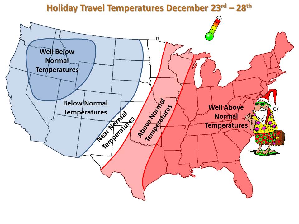
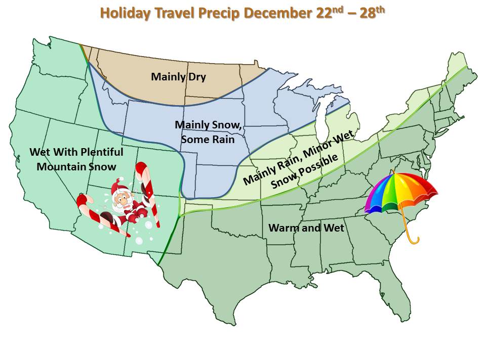
Pack skis for the West, umbrellas for the lower Midwest and Southeast and shorts for New England.  Shorts for New England might be stretching it, but here’s an overview of what to expect.

Holiday Travel Temperatures Holiday Travel Weather