Experience the Work of Young Scientists

March 13, 2013

Olathe North Students + Brains = The Energy of Science

The Battle of the Brains contest, sponsored by Burns & McDonnell, was designed to encourage practical, scientific thinking in young people.  The assignment was to create an interactive, science-based exhibit to boost participation at Science City while teaching applied scientific principles.

Olathe North students, including Kendra Schuette (niece of our owner Sara Croke), designed The Science of Energy.

Greg Graves, Chairman and CEO of Burns and McDonnell takes a spin on the power wheel and monitored how much electricity he was generating. via KC Star Rich Sugg Photographer

Jump on the massive hamster wheel for an easy ride to better understand what it takes for all of us to enjoy the privilege of energy.

Congratulations to sponsor, Burns & McDonnell, the winning team of Olathe North Students and Science City for balancing the equation.

FUN + SCIENCE = Innovative Learning


One of the Snowiest 7 Days on Record!

OP_SnowKansas City has been walloped by back-to-back storms that brought the city to a standstill. Schools, colleges, businesses and entire shopping malls were closed in both events that occurred less than a week apart from each other.  The 20.3″ between Thursday, February 21 and Wednesday, February 27 were the 2nd snowiest seven days in the Kansas City record books which date back to 1888.

The first event in Kansas City dumped 9.3 inches of snow (9.2 inches on February 21 and 0.1 inches on February 22) much of which came between 8am-12pm when snowfall rates peaked as high as 3 inches per hour and was accompanied by thunder! The 9.2 inches in a single day ranks 5th highest for the month of February. The situation turned dire within an hour of the start of the snow.  Traffic log jams created by stranded motorists were everywhere.  Even causing I-35 and highway 69 to close.  As a result, snow plows were immobilized across the metro and in some instances causing ambulances and other first responders from getting where they needed to go.

Crews worked tirelessly on Friday and through the weekend. Their purpose was the find a new home to the snow piles before the next blizzard-like blast arrived.  The next record breaking snow ramped up Monday night while most folks slept. Heavy wet snow accompanied by thunder continued through the morning hours on Tuesday, February 26th. Snow crews were battling again clearing more than 9 inches of snow that finally ended the following day. The three calendar day total for the event was measured at 11.0″ at the official observation station for Kansas City, the Kansas City International Airport.

While the chilly blast this weekend could bring spurts of flurries or light snow, no more records are expected to be set this week…

The 7 day period of February 21-27, 2013 resulted in 20.3″ of snow for KC!


The Snowiest 7-Day Periods on Kansas City Record (since 1888)

1) March 18-24, 1912  (25.1″)
2) February 21-27, 2013  (20.3″)
3) January 14-19, 1962  (19.8″)
4) March 27 – April 2, 1926  (18.8″)
5) January 12-18, 1960  (17.3″)


Don’t Skid. Don’t Skate. Call Ahead and Arrive Alive!

December 19, 2012

Your loved ones want you to drive safely and arrive alive.  Planning ahead means calling ahead. Do that with your 2012 Road Conditions Directory.  Highway departments want you to know how winter weather is impacting travel.  They update these toll-free numbers so you can plan the safest route.

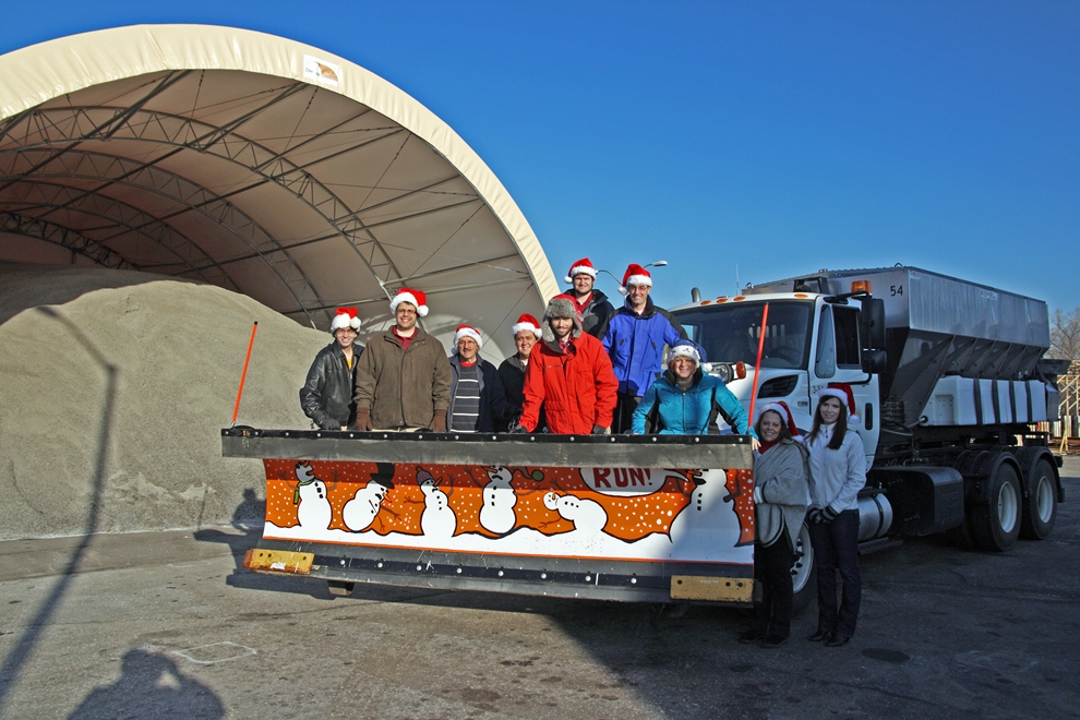
From Our Crew to Yours
Warmest Thoughts and Best Wishes
for a Wonderful Holiday Season
and a Very Happy New Year!


Door Shutting on Cold Air

November 28, 2012

Lows yesterday were 25-50 degrees colder than lows on Thanksgiving less than a week ago.

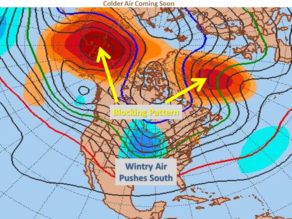
Some even saw some light snow Monday from Omaha to St. Joseph to Kansas City. This wintry weather was partially due to a blocking pattern that developed in the high latitudes. Previously it looked like the cold may stick around for a while. Now it’s becoming clear, winter is back on hold. Take a look at the upper-level pattern below.

Rather than two distinct areas of blocking, the blocking has elongated west to east across the northern hemisphere, forcing the coldest air into the Pacific and the northeastern U.S.. As the area of cold air and low pressure in the Pacific moves toward the West Coast this week, it will actually cause our temperatures to climb well above normal again.

If the current model trends are realized, we could be looking at record warm temperatures late this weekend into early next week

A weak weather system should bring temperatures back closer to normal by the middle of next week, however right now it looks like winter enthusiasts may be waiting until around the 8th -12th  of December for the next potential for wintry weather.


Change is on the Way

November 19, 2012

Break out the shorts for Thanksgiving, winter coats are just around the corner. High temperatures this time of year normally range from the mid-40s in eastern Nebraska to the low 50s from central Kansas to eastern Missouri. Temperatures this week are nowhere near normal with highs soaring into the upper 60s and even 70s in some locations.

If you’ve lived in the Midwest during the winter (last winter doesn’t count), you know the weather scales can tip quickly. Indeed they have already done so this fall (as you can see here).  It does look like temperatures will briefly dip after Thanksgiving. However, a much more impressive swing could be in store for the end of the month.

There are many factors meteorologists can look at in determining when the next cold air outbreak may occur in our region.  One of these factors is high latitude blocking. When high pressure forms over the high latitudes, cold polar air can be blocked southward into our area.  Mid-range forecast models are coming into agreement that a strong blocking pattern will set up over the north Atlantic and north Pacific by the 27th or 28th of November, sending our temperatures plunging by the end of the month.

There are also signs that a storm may try to develop over the western U.S. around that same time.  Depending on the track and timing of that potential system, wintry weather could be in store somewhere in our region for the end of the month into early December. No matter when changes come to the Midwest, W.O.N’s meteorologists will be notifying clients well ahead of time.


The Big Chill Moves Through

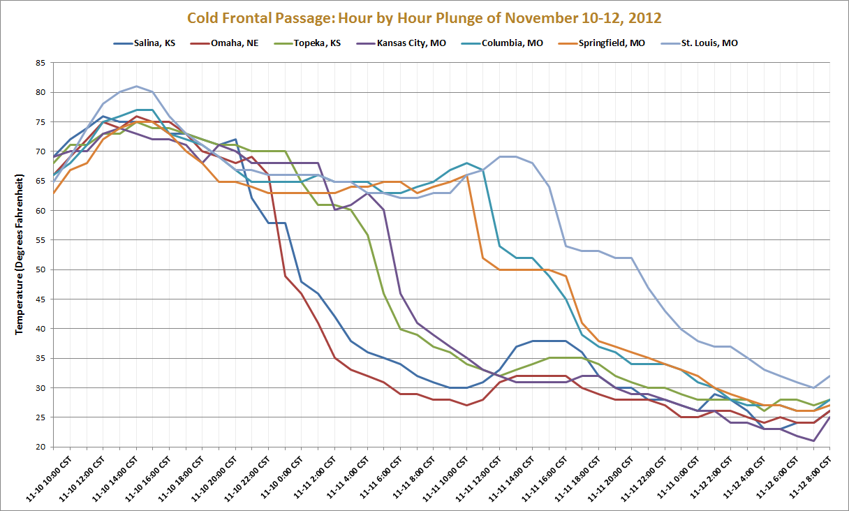
Ride along the cold front as it passed through the Central United States this weekend.  We went from t-shirts to turtlenecks as temperatures dropped 50 degrees in some cities. The nose diving temperatures were accompanied by rain and gusty winds making for a very raw time.

Follow the front from northwest to southeast, as it dramatically drops temperatures first in Salina and Omaha, then Topeka and Kansas City, through Mid-Missouri and Springfield, before finally pushing through St. Louis.


Safety Justifies Training Expenses

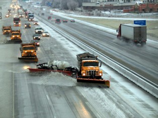
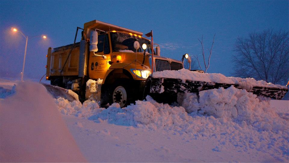
The Missouri Department of Transportation (MoDOT) has downsized from ten districts to seven, scaling back in areas many of us may never see.  People are screaming for smaller government. The economy has demanded it.  So when the agency that’s responsible for keeping I-70, I-35, I-29 and all state roadways safe for travelers and commerce takes one day to fully dress its fleet of snowplows spending $70,000 for fuel to make certain everyone knows their job when snow and ice hits, we should encourage their preparedness.  That cost is only 0.0017 of their $42 million winter budget.
Training first responders, which includes public works departments, saves lives.  In one of the American Public Works Association’s largest surveys to governments that had recently experienced a federally declared disaster, nearly 800 communities across the country agreed that training is a top priority.

As winter approaches with its challenges of snow and ice, remember that while doing more with less has become the mantra for most winter maintenance operations, Mother Nature doesn’t promise to back off.  We all must be prepared. Running snow routes and testing equipment and communications is simply common sense – and they don’t make an app for that.

Upon safely reaching your destination this winter, remember it’s possible because like all professional highway and public works departments, MoDOT invested in safety.


“Guess the Snowiest Winter Day Contest”

Winter Contest Poster


Here’s your chance to win a tablet computer and accessories!!!

Enter Weather or Not’s 2012-13 Winter Snow Contest by submitting your guess for the date and amount of the largest snowfall in any of Weather or Not’s regional cities!

Submit your entry by emailing info@weatherornot.com with the subject:  2012-13 Winter Snow Contest

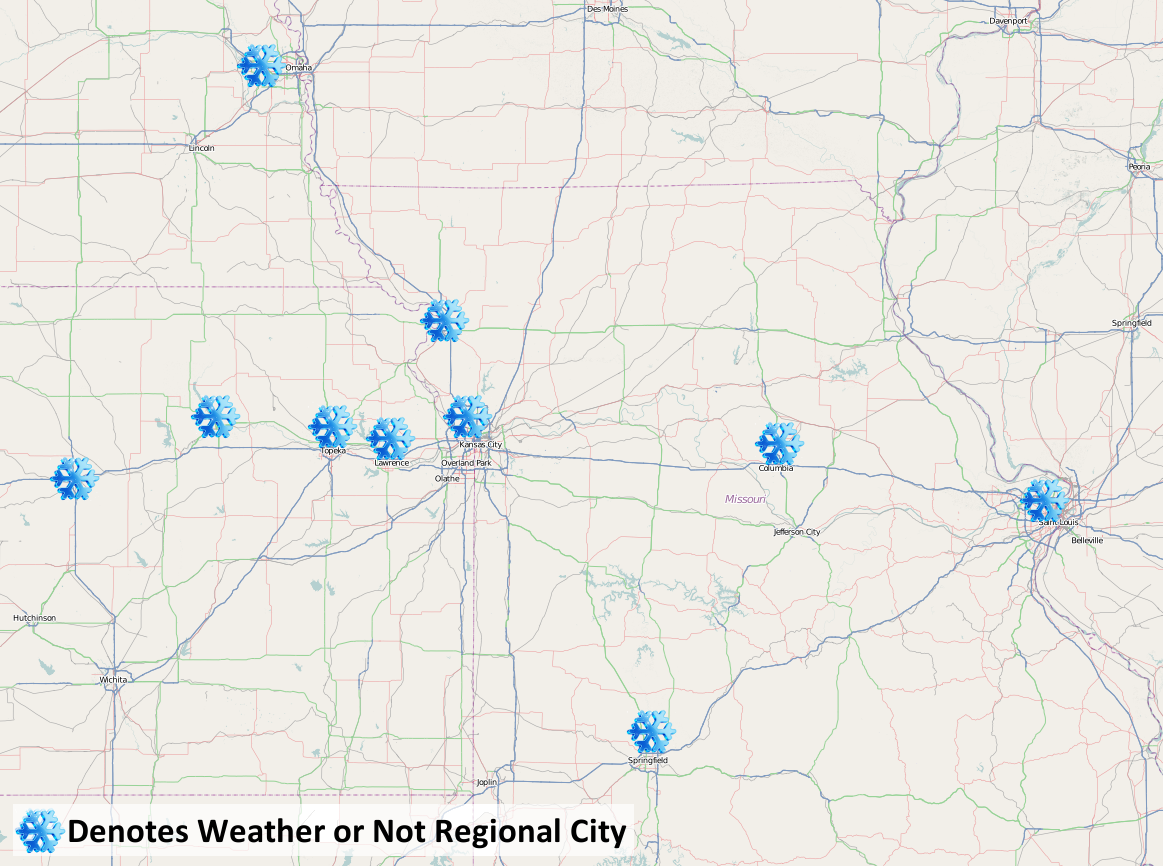
Your entry must include your name, snowiest date and snowfall amount for any of the regional cities within Weather or Not’s region (see map below for details).


EXAMPLEName:  Jane Doe – Date:  November 3rd – Snowfall Amount: – 16″


Entries must be received by November 1, 2012.  Limit of one (1) entry per person.  Employees and immediate family members of employees of Weather or Not, Inc. are not eligible to enter.  Winner is decided by the entry closest to the date (Midnight-Midnight) when the most snow falls as determined by the climatological station at any of the following cities: in Nebraska, Omaha; in Kansas: Salina, Manhattan, Topeka or Lawrence; in Missouri: St. Joseph, Kansas City, Springfield, Columbia or St. Louis.  Period of the contest is November 1, 2012 to April 15, 2013.  Winner will be announced here, as well as on our Facebook and Twitter by April 30, 2013.  In the event of a tie for the closest day, the entry closest to the actual measured amount of snow will determine the winner.  Employees of the Company and members of their immediate families  are not eligible to participate and win.


What will be the snowiest day in a Weather or Not Regional City?

Snow Contest Cities


Winner will receive a tablet computer and accessories.

Play Today!


Severe Weather: Not Just a Spring Thing

October 12, 2012

Severe weather threats including tornadoes are the big topic this weekend in the Midwest.  Many businesses are readying their operations for snow and winter these days.  However, this weekend, heavy rain, damaging winds and tornadoes could challenge many jurisdictions throughout the Heartland.

Why now?

Mistakenly, many people think there is a designated “severe weather season,” primarily because many of the most devastating tornadoes occur from March-June.  Tornado watches and warnings, and tornadoes for that matter, have happened in every month of the year.  Most recently, the St. Louis Metro had multiple tornadoes on December 31, 2010 including an EF-3 during a New Year’s Eve outbreak that included 24 tornadoes in Missouri.

Weather 101 tells us that weather is created by the atmosphere trying to balance itself. If the earth had its way, there would be consistent temperature, pressure, etc. The wind is the atmosphere’s fight to bring the earth to an equilibrium and that is why the bigger the differences, the bigger the storm.  When the warm Fall temperatures are mixed with moisture and colder, drier air pushing down from the north a fight ensues in the form of wind.  Add the right combination of instability and wind shear and you could be spotting tornadoes.

For Saturday, all of those ingredients should be in play for the Heartland.  Please stay alert to emergency messages, or sign up for a free trial of A+ Weather Alerts.  Weather or Not’s staff of meteorologists will be keeping our clients ahead of the storm  24/7.


Another October Freeze?

October 10, 2012


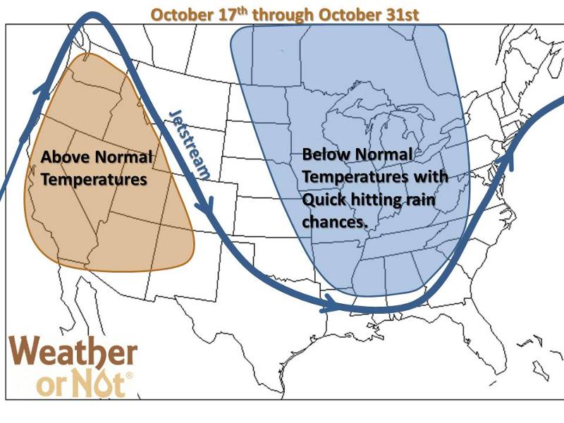
This week’s seasonal temperatures are courtesy of a transitional ridging pattern out West. The good news is that the southern jet stream could actually bring in moisture during this transitional period, October 13th-17th, offering us the best rain potential we’ve seen in awhile. Even severe weather could return this weekend.

Chilly weather returns for the latter half of the month, including Halloween, so enjoy the mild temperatures for the next week. As we head toward the end of the month, a deep trough will set up and looks to dominate the weather pattern across the eastern two-thirds of the country. This northwesterly flow leads to cooler conditions across the Midwest and Southeast. The much talked about El Niño remains weak with little effect on the overall pattern.

Late October Forecast

For the Heartland expect below normal temperatures from the 17th through the end of the month, as we will continue to have numerous cold fronts diving through the area. This will also lead to quick hitting rain chances, if we can squeeze out any moisture.