Please Sir, May We Have Some More…..Lots More?

August 9, 2012

Rumbles of thunder and the pitter-patter of rain last night brought hope to many across the area.   The biggest smiles were found in St. Charles, MO  where they saw over two inches of rain!  However, most of us felt teased as it barely settled the dust.

8-8

How much will it take to really make a difference?

A whole lot more than just normal precipitation is needed, especially in the Central Plains. An occasional inch or two of rain might green up your brown, crunchy lawn, but it will do little to regenerate your local water shed.   An extended period of above normal precipitation is needed to chip away at the deficit and restore the water supply.

Additional Precipitation Needed


Is the Reprieve Here to Stay?

August 6, 2012

Expected Pattern 8-5

While rejoicing about this morning (lows 56 to 68), many are asking, will the persistent heat return? Thankfully, the answer is not yet. Earlier indications were that the scorching heat would return for the 10th through the 15th, but some welcome changes have occurred. Models now agree that the hot dome of high pressure stays west of the area, at least through the middle of next week. This means multiple cold fronts for the Missouri River Valley. Highs will climb above 90 ahead of the fronts, and drop below 90 behind the fronts, with no persistent 100+ stretches in sight. We look forward to occasional rain chances; not drought busting rains, but certainly welcome nonetheless. The jury is still out on the second half of the month. With the drought continuing, another heat wave could certainly be in store, but for now, watch for more pleasant days ahead!


8-5


July 2012: Record Breaking!

Most people across the region came to the conclusion that July was hot and dry, however just how hot and how dry?  We have gathered data for several cities across the area, finding the Top 10 hottest and Top 10 driest Julys on record. Each city had a July average temperature that ranked in the Top 10, with St. Louis having the hottest July on record.  While it was also dry across the region, the precipitation numbers vary a lot more than temperature as isolated thunderstorms provided hit and miss rainfall.  For example, Omaha managed to have their driest July on record with only 0.01″ of precipitation, which also ranks as their sixth driest month ever!  Meanwhile, Columbia managed to see a few of those hit and miss thunderstorms, which led to 1.56″ of precipitation, making it their 26th driest July.  Check out how your city ranks with the graphs below:


Omaha, NE

St. Joseph, MO

Kansas City, MO

Columbia, MO

St. Louis, MO

Springfield, MO


No Real Break in Sight

July 31, 2012


Occasional showers bring cloudy relief to a lucky few this week, but where the sun’s shining, temperatures continue climbing. This pattern is slightly nicer than the pattern we’ve seen so far this summer, with the ridge displaced slightly west. This keeps the hottest and driest weather just west of the Missouri River Valley.  As disturbances form over the Desert Southwest, they can climb up and over the ridge, spilling occasional rain chances into our area (ISO 1-1.5).  Unfortunately the lack of coverage and intensity of any rainfall continues to disappoint most thirsty lawns.

More widespread heat relief and rain chances arrive this weekend as another weak cold front moves through the region. The best potential to be closer to 90 than 100 should be the first day or two after the front passes. Then as the front retreats between the 6th-8th of August, there will likely be a gradual warm-up from west to east, with isolated rain chances continuing. After the 8th, the dome centers over us again causing the rain chances to decrease and heat to increase, with the next potential heat wave looming on the horizon sometime around the 10th-15th of August.  So, other than a few lucky locations, there are no signs of significant relief to the ongoing drought or sweltering summer heat.


Drought Monitor (July 24, 2012)

July 26, 2012

The latest drought monitor has been released and the Central Plains saw conditions slightly worsen over the past week.  Although there was some rainfall that occurred this morning across the area, the latest update only includes precipitation through 6am CST on July 24.  The contiguous United States has just over 80% of the county with abnormally dry or worse conditions, a whopping 63.9% actually in some form of drought.  To make matters worse, over 20% of the country is in extreme or exceptional drought, first time since mid-February 2003.  Below is a closer look at individual states:


Nebraska

100% of the state is in severe or worse drought with a majority (64%) actually in extreme or worse.  Eastern Nebraska has managed some rain recently which has provided it with slightly better conditions, while the central portion of the state sees the first exceptional drought rating for Nebraska since July of 2004.  Like many other states, three months ago there was a single acre in Nebraska being designated in severe or worse drought, indicating just how quickly the lack of rainfall has built up.


Kansas

Kansas also has 100% of the state in severe or worse drought conditions with the latest drought update, and a large majority (over 72%) in extreme or exceptional drought.  Extreme drought covers much of western Kansas and extends across portions of the entire state, including the metro areas of Wichita, Topeka and the Kansas City area.  While less than a year ago there was nearly 18% of the state in exceptional drought compared to the current 9% the difference lies in the sheer expansive nature of this drought, only 75% of the state was in a form of drought then.


Missouri

As you could have expected, Missouri is another one of the four states that has 100% of their area in severe or worse drought (Iowa is the other along with Kansas and Nebraska).  The southeast portion of the state is hardest hit, where parts of 11 counties have been designated in exceptional or worse drought.  Extreme drought covers a large portion of the state, including the St. Louis Metro, Kansas City Metro and the cities of Springfield, Columbia and many more.  The cities of Jefferson City and Joplin are currently designated in only severe drought, however with little rain in sight for the next week they could see the extreme category in the next update.


Businesses Heating Up

Clarkson Construction Project - I-435 & 69 Highway

Clarkson Construction Project – I-435 & 69 Highway

There’s a 100% chance for record breaking attendance at any venue that conjures up a feeling of “cool and comfortable” during this heat wave. However, outdoor businesses and their workers are forced to strategically re-think their operations when the heat is on.

One business dramatically affected is highway construction. Specs for bridge deck work state that the air temperature cannot be above 90°, nor the concrete temperature above 85° when pouring. Other highway concrete work has a constraint that the concrete temperature be no greater than 90° when poured.

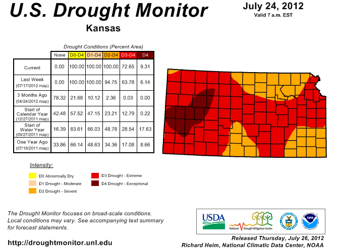
The options available to contractors under extreme heat are cumbersome and costly. One process many ready-mix plants throughout the steamy Midwest use is “watering” piles of aggregates with sprinklers before they get mixed. Drive by the 69 Highway Project in the KC area and you’ll see them using this “cooling” solution.

The most expensive and labor intensive option is buying ice to dump right into the concrete trucks. We’re not talking about a few cubes for your mint julep. The size and distribution of the ice means that contractors have to find special suppliers to get it into the trucks at just the right time and just the right mix to prevent “flash setting”. In other words, “mixing” is critical to concrete on its way to the job site. “Flash setting” in the truck would not allow for them to even pour it.

As expensive as a chilled water system or ice product is to contractors, they also have to manage their crews effectively. With crew safety in mind, Clarkson Construction Company won’t let labor crews work more than 8 hour days for a total of 40 hours a week during dangerously hot conditions. Big state work has crucial time frames though, so scheduling is an added pressure to running a successful highway construction business this time of year.

Helping our clients maximize their profits is what we do! We are proud to be “on the job” with these dedicated companies.
Disclaimer: 24/7 our team of meteorologists are in an air conditioned, state-of-the-art weather center.


Olathe Girls Softball Took Action

GAME OVER.  Lightning warnings from Weather or Not had already caused Dave Jones, OGSA General Manager, to send players and patrons home.  Storms would not move from the area for several hours so “waiting it out” was not an option.  Some players and families were still lingering in the area when the tornado warning was issued, Dave calmly alerted the remaining bystanders to take shelter immediately.  Read more on how the storms on Sunday posed a threat to crowds at public athletic fields.